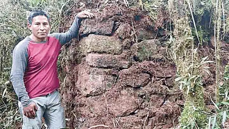
One of the site's stone walls, still covered in moss and dense vegetation.
Expedition tour — Lacco Valley
The alternative ending to the Inca exodus toward Machu Picchu / Vilcabamba — the last great journey of the Incas is believed to have passed through the Sacred Valley (Kallarayan, Huchuy Cusco), the Lacco valley, before ending at Paititi (probably located in the Pantiacolla plateau, north of the Toporaké mountain range). A 12-18 day expedition to a pyramidal site discovered in 2017, 5 days' walk from the Lacco valley or another exploration zone.
The pyramidal site was discovered in 2017 by Javier Pazo Chipa, Benancio Encalada Paravicino, Justo Huamán Poma, and Belisario Álvarez Ocampo. The Dirección Desconcentrada de Cultura de Cusco (DDCC) officially confirmed that the site was unknown in its records.
In addition, the pyramidal site is thought to be connected to the Qhapaq Ñan (the Inca road network) via a dedicated section, at least part of which is supported by a retaining wall, sometimes accompanied by large buildings resembling kallankas. This site is probably linked to Pantiacollo or Paititi, given its direct connection to the Pantiacolla plateau, as well as to the Patoqchayoq site — 200 dwellings — located in the Chunchosmayo quebrada, discovered (or rediscovered?) in 2020.
One of the site's stone walls, still covered in moss and dense vegetation.
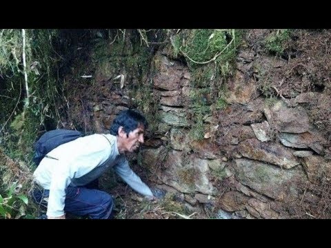
First contact with one of the site's walls, still wrapped in moss and vegetation. Photo taken during the 2017 expedition.
The expedition first heads to the limits of the Megantoni National Sanctuary, without entering it, paying the corresponding TUPA fee to the local Sernanp, with the agreement of the area's campesinos. It includes a survey of the ruins along the Toporaké range, indicating the presence of the pyramidal site found in 2017 and those leading toward the lost city probably accompanying it, not yet discovered.
Depending on the authorizations obtained from the Peruvian administration, this second, much more physical stage consists of taking part in cleaning the pyramidal site within Megantoni — whose real extent remains unknown, but which covers at least one hectare of terracing, platforms, corral walls, and andenes — or exploring other nearby sites, including the famous lost city called Pantiacollo or Paititi (probably located in the Pantiacolla plateau, north of the Toporaké mountain range), according to tradition. This lost city would accompany the pyramidal site and is probably located on a nearby height.
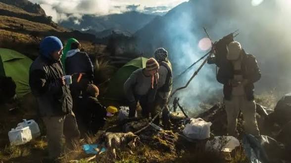
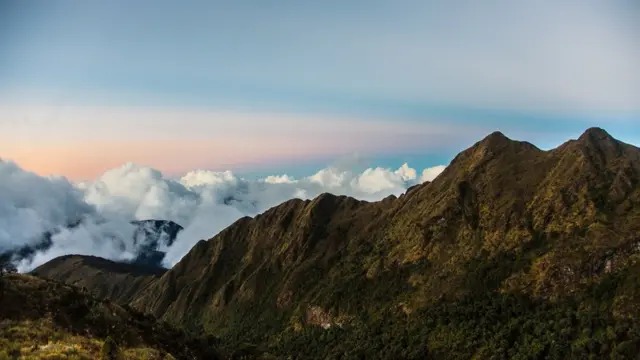
The Andean foothills, among the clouds — the landscape the last Inca expedition toward Paititi would have seen. Photo taken during the 2016 expedition, which included 3 Westerners.
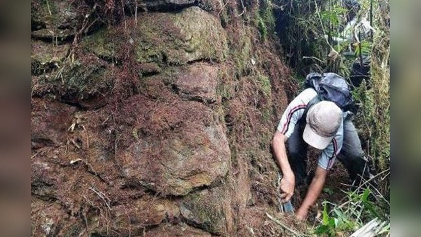
Clean-up and clearing work on one of the walls, tool in hand.
The trek begins after a motorized approach (car, bus, or truck) of one to two days from Cusco, depending on road conditions, passing through the Quebrada de Yanatile. The walking trek, whether toward the site to be cleaned or toward the lost city exploration zone (probably located in the Pantiacolla plateau, north of the Toporaké mountain range), crosses the Toporaké area.
This tour accumulates between 7,000 and potentially 10,000–12,000 meters of cumulative elevation gain, depending on the exact configuration of the expedition, spread over 12 to 18 days of successive camps — under tent or tarp —, with one or more camps possible up to a maximum altitude of 4,000 meters.
Base camp at the end of the day — fire, first stars, and rest before the next stage.
The route crosses the Andean foothills, a low forest covering the slopes up to 3,000 m, extremely dense — far more so than lowland Amazon rainforest. Some stretches are therefore very slow and must be cut open with a machete, work that is always subject to prior Sernanp authorization; certain days cannot exceed 2 km of distance covered, even for the most well-trained profiles.
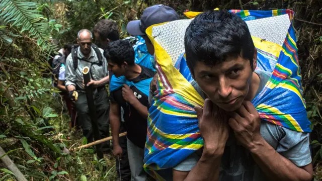
Moving single-file through the dense foothill forest — the pace is set by the hardest stretch, not the fastest one.
The initial ascent from Lacco (3 days) can be done with the help of mules, but the human load remains significant: between 10 and 35 kg, depending on each participant's capacity.
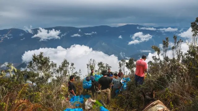
Shared portage at altitude, above the clouds, on the way to camp.
The expedition format adapts to the participants, but this is undeniably an extreme trek — even unique of its kind.
Given the extreme and variable nature of this expedition, the budget does not follow a fixed rate.
The budget for this expedition is designed together by the candidate and the guides who will accompany them. It varies based on the exact configuration of the trek, its duration (12 to 18 days), the required equipment, and the necessary authorizations.
Contact us directly on WhatsApp for more information and availability.
Prefer a cultural day to an extreme trek? Discover our authentic pachamanca and Inca weaving experience with the Kallarayan community.